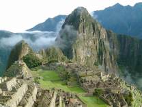
Patallacta
Patallacta (possibly from Quechua pata elevated place / above, at the top / edge, bank (of a river), shore, llaqta place (village, town, city, country, nation), "settlement on a platform" pronounced "pahta-yakta"), Llactapata or Q'ente Marka (possibly from Quechua q'inti hummingbird, marka village, "hummingbird village") is an archaeological site in Peru located in the Cusco Region, Urubamba Province, Machupicchu District. It is situated southeast of the site Machu Picchu, at the confluence of the rivers Cusichaca and Vilcanota on a mountain named Patallacta.
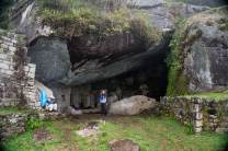
On his way to discover Machu Picchu (at: 13°13′57″S 72°25′30″W / 13.2325095°S 72.424922°W / -13.2325095; -72.424922) Hiram Bingham, discoverer of Machu Picchu and many other Incan sites, passed Patallacta, sometimes given the name of Llaqtapata as evidenced by the photograph of a sign from a check-point along the Inca trail. His associate Mr. Herman Tucker reported that the name of the town was Patallacta containing about one hundred houses. Above it were several important sites including Huayllabamba. This site is located 1.5 km (1 mi) away from the start of the "Classic Inca Trail".
This site housed a large number of occupants, including travellers and soldiers who manned the nearby "hill fort" of Willkaraqay, and a shrine with rounded walls known as Pulpituyuq that had religious and ceremonial...