No video yet


Uvac
The Uvac (Serbian Cyrillic: Увац) is an international trans-boundary river, rising under Golija mountain and Pešter plateau, then flowing through southwestern Serbia and cross into eastern Bosnia and Herzegovina where, after 115 km, finally meets the Lim river from the right, however, before it empties into the Lim, for a 10 kilometers Uvac forms the border between two countries. Also, while meandering through Serbia, Uvac loosely makes the northern border of the Raška region too.
Upper course
The Uvac originates in the Pešter plateau from the Ninaja mountain, as Rasanska reka (Cyrillic: Расанска река). The stream curves around the Ninaja and Pometenik mountains, next to the villages of Tuzinje, Rasno, Dragojloviće and Gradac, where it meets Brnjička reka (Cyrillic: Брњичка река), enters the Sjenica depression and continues on depression eastern border as the Vapa (Cyrillic: Вапа), which is 25 kilometers long and drains an area of 496 km².
The river passes next to the villages of Gornja Vapa, Donja Vapa, Čedovo and Krstac, where the Vapa receives from the left the short river Uvac, which originates on the Ozren mountain, and gives name to the downstream course of the river.
Lower course
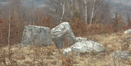
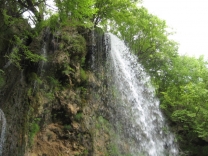
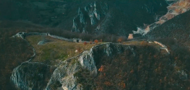
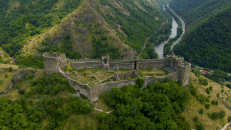
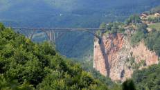
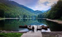
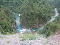
The Uvac continues to the northwest, enters the Stari Vlah region where it flows in a deep, canyon-like valley, where it receives the Kladnica river from the right and generates lots of power, which is used for three powerful hydroelectric power stations, each one with big artificial lake: Bistrica with Lake Radoinja, Kokin Brod with Zlatar Lake (7,3 km², altitude 400 m, depth 40 m) and Sjenica with Lake Sjenica.
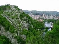
In the lowest part of its course, The Uvac flows between the Zlatar and Zlatibor mountains, next to the villages of Kokin Brod and Radoinja until it reaches the Bosnian border and Varda mountain, makes a sharp, elbow turn to the south and after a short flow next to the villages of Bjelušine and Uvac (both on Bosnian side), the Uvac empties into the Lim, north of the city of Priboj.
The Uvac drains an area of 1,596 km², belongs to the Black Sea drainage basin, and it is not navigable. Its...